 Landplot for iOS & Android
Map any field, right from your phone
Drop markers, draw areas, and record GPS tracks on a satellite map. Measure as you go, attach photos, and export to KML or GeoJSON. Works offline, no account needed.
See how it works
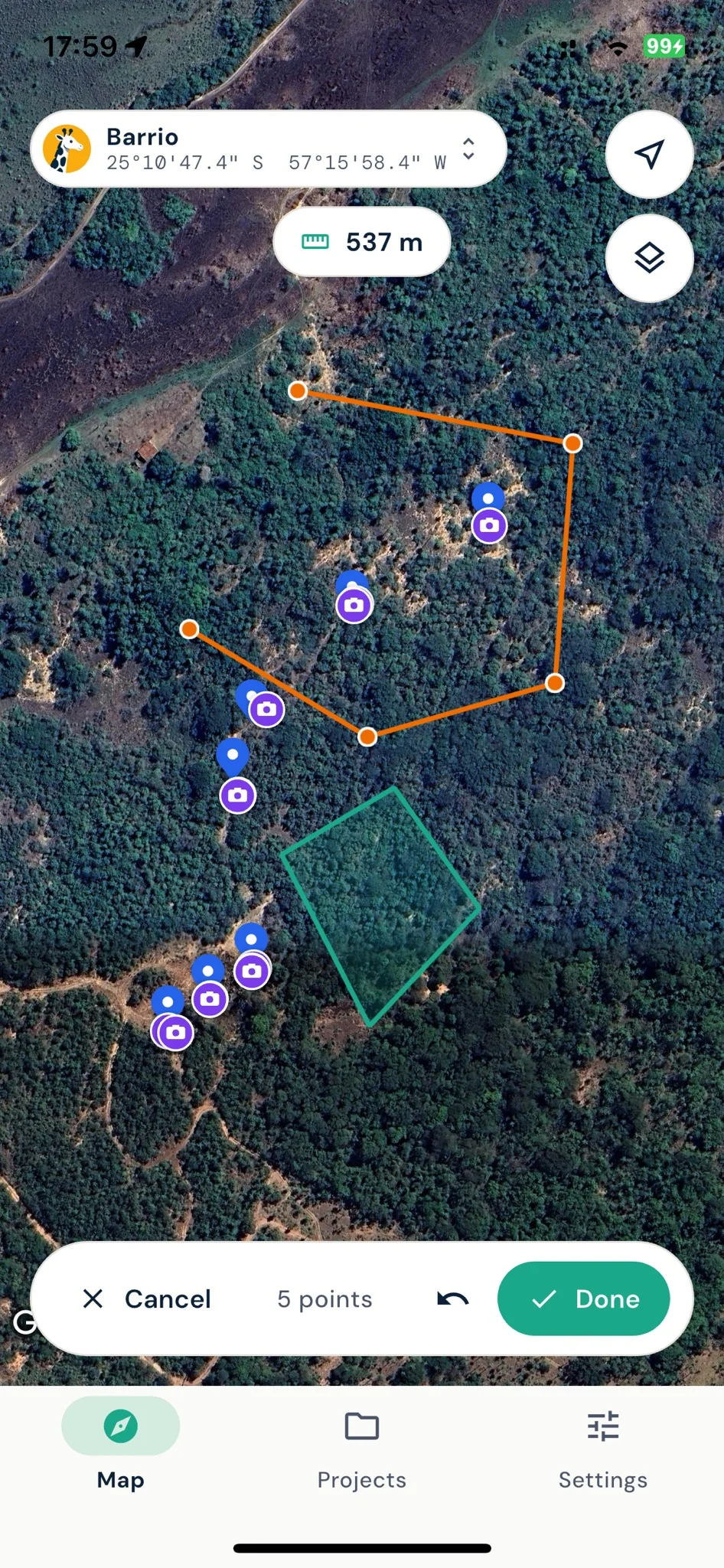
Measure as you draw
Tap corner to corner to outline an area, or walk the boundary and let GPS do the work.
- Markers, lines, and areas on a satellite map
- Record a walked path with GPS
- Live length, area, and perimeter as you draw
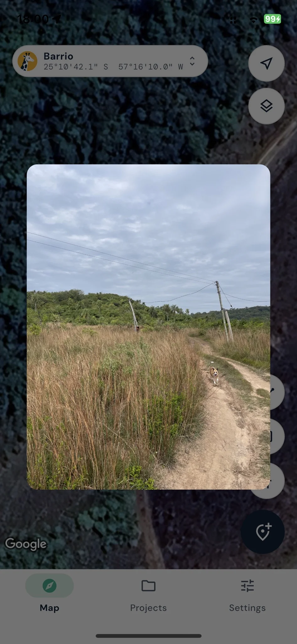
Photos pinned to the spot
Snap a photo and it stays tied to that location, ready to export with everything else.
- Geotagged photos on any marker
- Tap to view full screen on the map
- Photos travel with your exported data
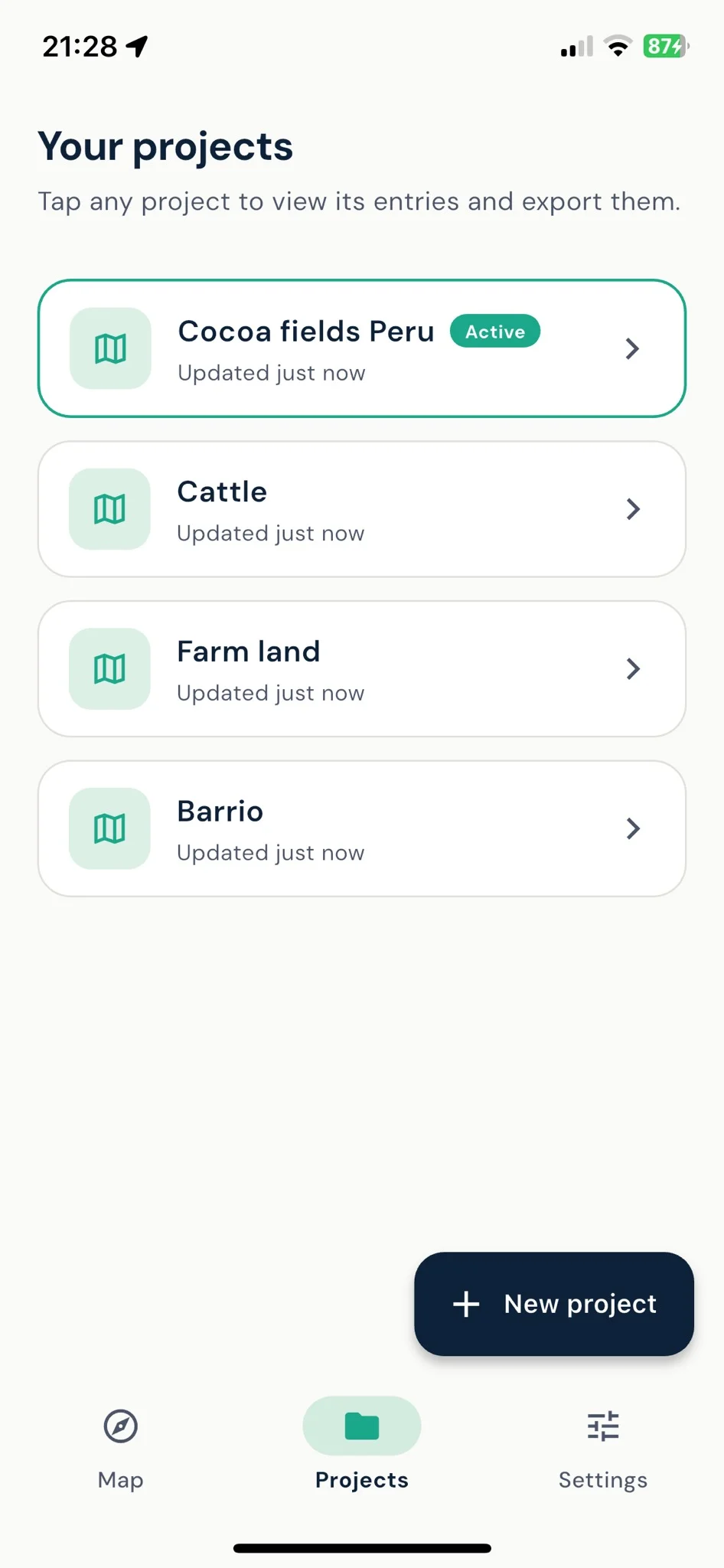
Every site in its own project
Group your markers, tracks, and areas into projects so each field, farm, or plot stays separate and easy to find.
- Switch between projects in a tap
- See what changed and when
- Export each project on its own
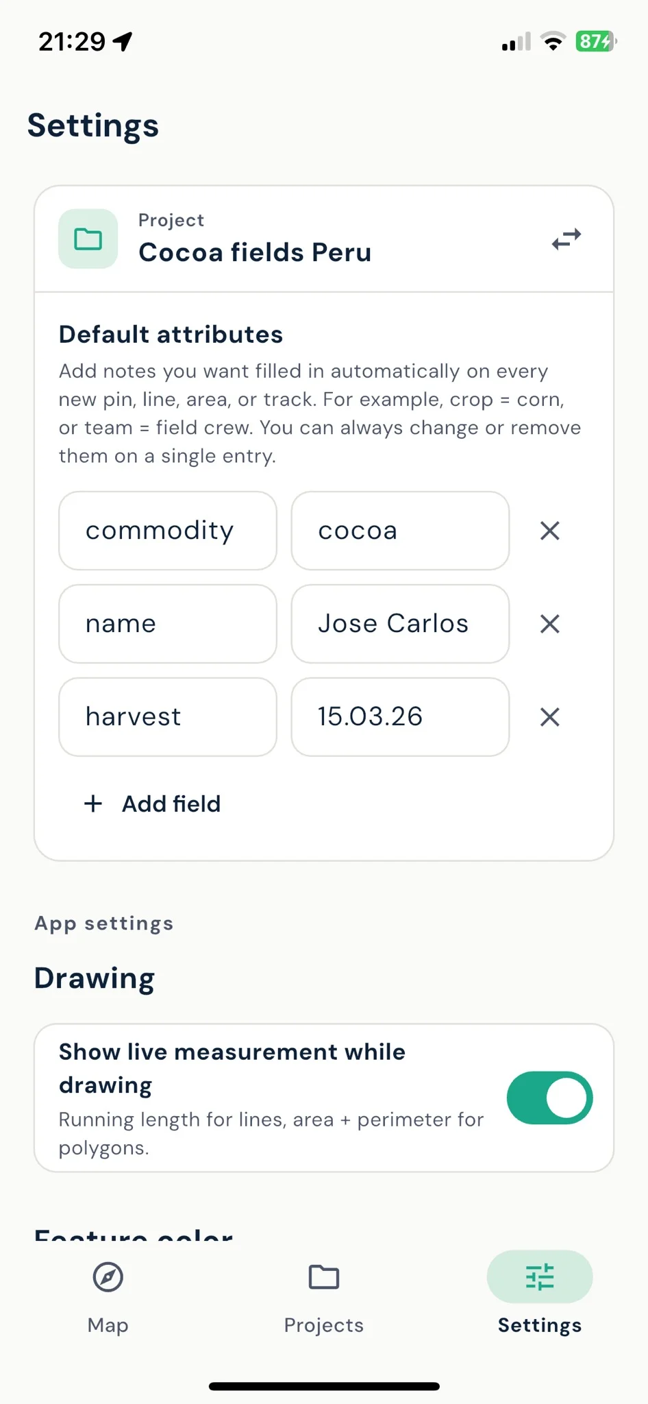
Set it up once
Add default notes like crop type or field crew once, then tweak per entry when you need to.
- Default attributes auto-fill every new pin, line, or area
- Toggle live measurement while drawing
- Works fully offline, no account needed
Files that just open
Export a project as KML, KMZ with embedded photos, or GeoJSON. No conversion, no extra software.
- Open in Google Earth
- Open in QGIS and ArcGIS
- Share by AirDrop, email, or share menu
Mapped it on your phone? Take it further
Open your export on georaf.com to convert between formats, clean up the data, and embed a live map on any website.
Explore Georaf for webGet Landplot free
Map your first plot in minutes. No account, no signup.